You are here
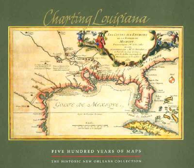
Back to topCharting Louisiana: Five Hundred Years of Maps (Hardcover)
$95.00
Usually Ships in 1-5 Days
Description
To celebrate the bicentennial of the Louisiana Purchase, The Historic New Orleans Collection (THNOC) has pursued the ambitious goal of publishing an atlas that depicts Louisiana's history through maps. The result of those efforts is Charting Louisiana. This book, THNOC's bicentennial gift to the public, offers a rich selection of historic and contemporary maps from various sources that collectively illustrate the region's diverse history, from its multinational colonial experiences to the modern American state.
Charting Louisiana presents 104 maps from THNOC's holdings, representing the full range of the institution's cartographic treasures. The atlas also features sixty-seven important works from the Geography and Map Division of the Library of Congress—custodian of the largest cartographic collection in the world—and contributions from other United States repositories, including the Louisiana State Museum and Chicago's Newberry Library. Archives in France, Spain, Great Britain, and Mexico generously provided the balance, as befits Louisiana's international history.
The product of this cooperative effort is an unprecedented compilation of 193 high-quality reproductions of important maps illustrating the development of Louisiana from the early sixteenth century to the present, along with historical essays providing a broader context for understanding the maps. Complete with a detailed cartobibliography and list of selected readings, Charting Louisiana is a lush, captivating, and valuable source of information for history buffs, scholars, and map lovers, providing ample opportunities for new interpretations of the state's history as well as that of the nation.
About the Author
Alfred E. Lemmon is the director of The Historic New Orleans Collection's Williams Research Center.
John T. Magill is a curator in charge of the reading room at the Williams Research Center.
Jason R. Wiese is the special collections/ projects librarian at The Historic New Orleans Collection.
John R. Hébert is the chief of the Geography and Map Division of the Library of Congress.