You are here
Back to topNational Geographic Canada National Parks Wall Map - Laminated (42 X 30 In) (National Geographic Reference Map) (Not Folded)
(This book cannot be returned.)
Description
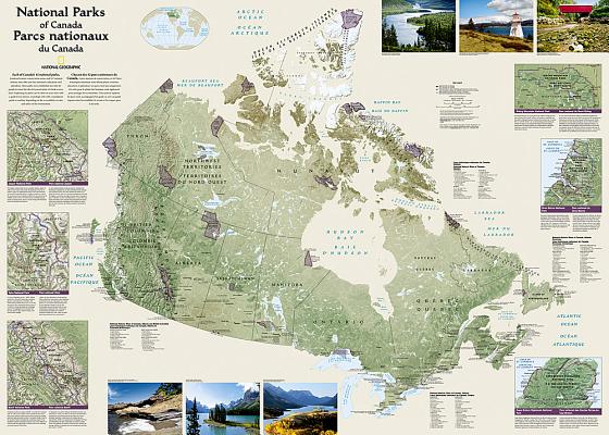
Expertly researched and designed, National Geographic's wall map of Canada's National Parks highlights the magnificent parks, marine conservation areas and historic sites across the country. This French-English bilingual map, is beautifully rendered with shaded relief and clear national boundaries of provinces and territories. Hundreds of cities, including provincial capitals are pinpointed and labeled in easy-to-read fonts. Colorful photos capture some of the diverse landscapes preserved and protected by the national park system. Separate inset maps provide detail and descriptions of several of the most popular parks including Jasper, Yoho, Banff, Riding Mountain, Gros Morne and Cape Breton Highlands.
The map is encapsulated in heavy-duty 1.6 mil laminate which makes the paper much more durable and resistant to the swelling and shrinking caused by changes in humidity. Laminated maps can be framed without the need for glass, so the frames can be much lighter and less expensive.
Map Scale = 1:6,400,000Sheet Size = 42" x 30"